
The first tropical storm of the Atlantic season is expected to form over the Gulf of Mexico Wednesday, the National Hurricane Center said, giving the disturbance an 80% chance of getting the distinction. It would be named Alberto.
Forecasters said it could bring heavy rains, coastal flooding and gusty winds to the Texas and northeastern Mexico coasts through Thursday. Alberto is likely to reach the Mexican coast late Wednesday or early Thursday. On Wednesday morning, the National Hurricane Center said the storm system was “lumbering” towards the region at about 8 miles per hour.
A Tropical Storm Warning was issued for the Texas coast from the San Luis Pass south to the mouth of the Rio Grande and the northeastern coast of Mexico from the Rio Grande mouth to Puerto de Altamira.
Rainfall amounts of 5 to 10 inches are possible across northeast Mexico into southern Texas, with maximum totals of 15 inches, and they’d probably result in “considerable flash and urban flooding along with new and renewed river flooding. Mudslides are also possible in areas of higher terrain across northeast Mexico,” meteorologists said. A storm surge as high as four feet might hit parts of the Texas coast.
The National Weather Service said on Wednesday morning that overall rain totals have decreased. Most areas will likely see between 1 to 3 inches of rain, the forecasting center said, but local flooding of 4 inches or more is possible. A flood watch remains in effect until Thursday.
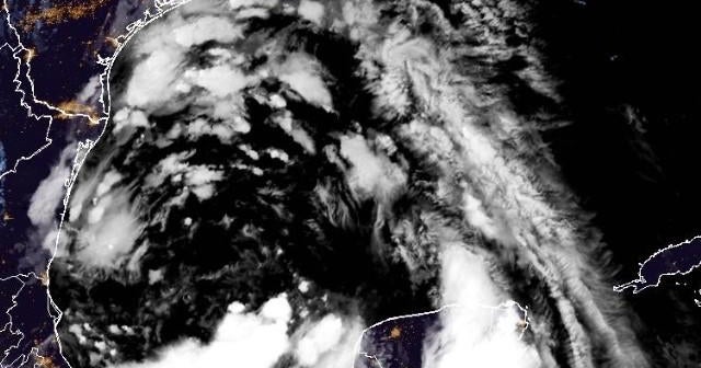
The disturbance was “quite large” early Wednesday, the hurricane center noted, with tropical-storm-force winds extending up to 415 miles to the north of the system’s center.
As of 4 a.m. CDT, the center was some 315 miles southeast of Brownsville, Texas and moving west-northwest at 8 mph with maximum sustained winds of 40 mph.
The hurricane center upgraded what had been the season’s first tropical storm watch to a tropical storm warning at 4 a.m. CT on Tuesday. Three hours later, the government of Mexico issued a tropical storm warning for the parts of the country’s northeastern coast, south of the mouth of the Rio Grande to Puerto de Altamira, replacing the tropical storm watch previously in effect there. The difference accounts for timing — forecasters will generally issue a “watch” when tropical storm conditions are possible in the impacted area within roughly 48 hours, and a “warning” when the conditions become more imminent, about 36 hours out.
The Atlantic hurricane season officially began June 1 and runs through the end of November, with most storm activity typically happening during the later months of that window, between mid-August and mid-October. The terms hurricane and tropical cyclone can refer to the same kind of storm, with meteorologists using tropical cyclone as a broad classification that includes any weather phenomenon where rotating, low-level cloud systems and thunderstorms develop over tropical or subtropical waters, according to the National Oceanic and Atmospheric Administration.
A tropical cyclone is categorized more specifically as a tropical storm once its maximum wind speeds exceed 39 mph. When sustained winds reach 74 mph or higher, it becomes a hurricane.
